Browse Items (67 total)
- Item Type: Historical map
Sort by:

Note from Rumsey: Outline color lithograph map of steamship communications, railways and postal network in the Russian Empire, dissected into 32 pieces, folded into sections 16x21, mounted mounted on linen. With 10 insets including: Karta…

This map can be found on page 531 of Baedeker's Handbook. This particular copy was made accessible by the Getty Research Institute and HathiTrust. Click here to read the catalog entry.
The plans in this collection are annotated and tagged in the…

This map can be found on page 221 of Baedeker's Handbook. This particular copy was made accessible by the Getty Research Institute and HathiTrust. Click here to read the catalog entry.
The plans in this collection are annotated and tagged in the…

This map can be found on page 220 of Baedeker's Handbook. This particular copy was made accessible by the Getty Research Institute and HathiTrust. Click here to read the catalog entry.
The plans in this collection are annotated and tagged in the…

This map can be found on page 231 of Baedeker's Handbook. This particular copy was made accessible by the Getty Research Institute and HathiTrust. Click here to read the catalog entry.
The plans in this collection are annotated and tagged in the…
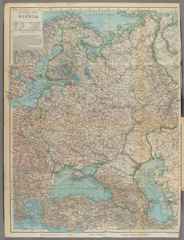
Map no. 32 in the Neuer Handatlas shows Russland or, in this case, European Russia. The scale is 1:8,250,000.
Rail lines are depicted in red.
Rail lines are depicted in red.

This map can be found on page 425 of Baedeker's Handbook. This particular copy was made accessible by the Getty Research Institute and HathiTrust. Click here to read the catalog entry.
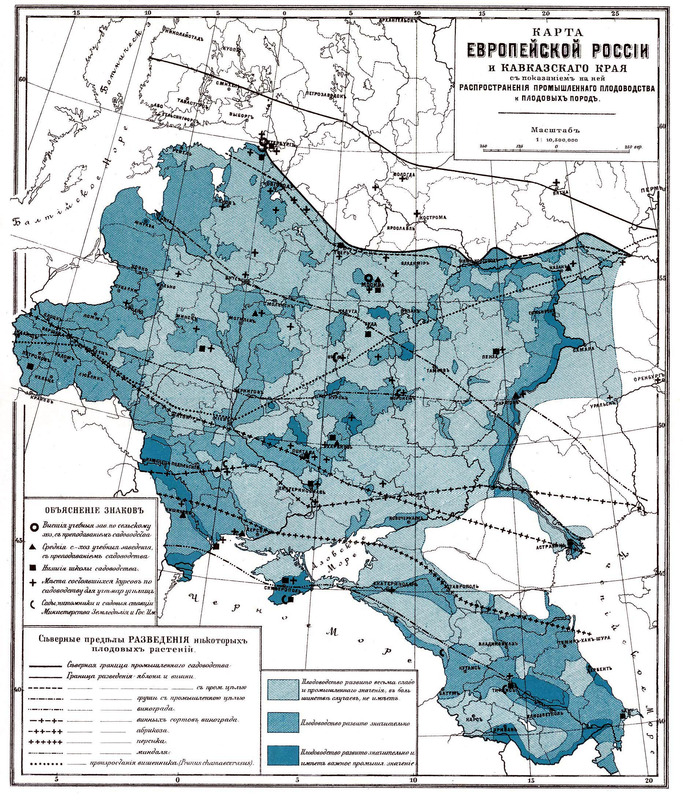
Here is a typical 19th century thematic map. The symbolization scheme is complex, using color, line, and symbol to communicate three different observations: the level of development of the fruit industry, the distribution of fruit varieties, and the…

This map can be found on page 69 of Baedeker's Handbook. This particular copy was made accessible by the Getty Research Institute and HathiTrust. Click here to read the catalog entry.
The plans in this collection are annotated and tagged in the…

This map can be found on page 545 of Baedeker's Handbook. This particular copy was made accessible by the Getty Research Institute and HathiTrust. Click here to read the catalog entry.
The plans in this collection are annotated and tagged in the…