The Bessarabian puzzle
As careful as we have been to trace and identify the administrative boundaries depicted on the atlas, at times it is difficult to do either with great confidence. A case in point is that of the oblast' of Bessarabia, in the southwest corner of the empire.
Bessarabia was annexed to the empire in 1812 and, like Kavkazskaia oblast', masqueraded as a "regular" part of the empire by virtue of its "oblast'" status. According to the explanatory text on the atlas sheet, Bessarabia had 6 tsinuty. I drew a rough equivalence between these units and the regular districts, or uezds, and all would been well and good were it not for the inclusion of four sub-units, or okrugs: Prutskoj, Kagul'skoj, Izmailskoj, and Budzhakskoj.
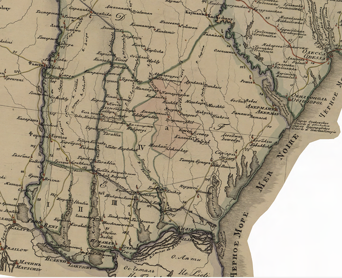
As far as I can tell, the tsynut boundaries are here:
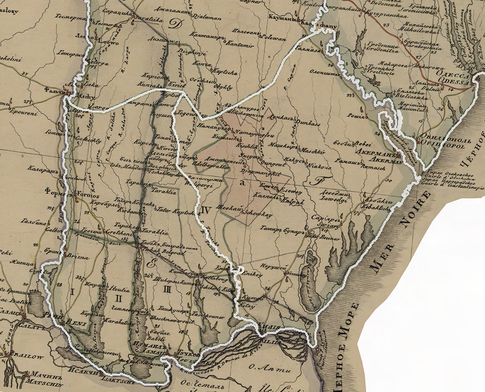
But it is no easy matter to disentagle the proliferation of dashed, dotted, and consistent lines, which describe both boundaries and rivers:
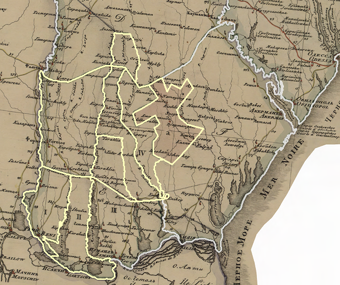
One piece of the puzzle is clearly the territory settled by German and Polish colonists. It is marked with a lower-case "a" in the map below:


But the boundaries of the okrugs, or sub-units, are not easily resolved. They are marked with Roman numbers I, II, III, and IV.
This is the real headache-inducing bit:
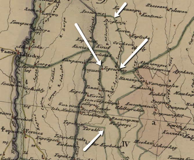
The arrows point to some of the places where rivers morph into dotted boundary lines, where rrivers that serve as boundaries suddenly relinquish that status, and where dotted and dashed lines seem to dissolve into vague linear suggestions that a boundary might or might not continue.
This complexity fades into the background of the project data, mainly because the district boundary map layer contains only (what I think are) the tsinut lines. A necessary evil, I suppose. A puzzle awaiting a solution.