The Spatial Profile of the Tsarist Empire
Let's start with the obvious question: What is a spatial profile?
By "spatial profile" I have in mind the following idea: that any place - any area located on the surface of the Earth, no matter its size - has a set of characteristics that define it, lend it coherence, and allow it to be imbued with meaning through human thought or action. Those characteristics are both physical and cultural. And a spatial profile is a sketch of those characteristics. A list of features. An index of components. A way of isolating the elements of a given place (here the Russian Empire) in such a way that we can describe them and think more deeply about the ways that they connect to, rely on, or even work against, each other.
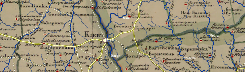
This description of the empire's spatial profile is based solely on the data extracted from the Geographical Atlas. It therefore describes Russia at a particular moment in time: after the annexation of Georgia (1801), the formation of the Grand Duchy of Finland (1809), and the annexation of Bessarabia (1812), but before the conquest of the North Caucasus or Central Asia. It describes the empire from a particular perspective as well: an official perspective which, when paired as it is here with technical sophistication, we tend to accept as "accurate."
There is no doubt that the atlas is rich with information. The spatial profile consists, in fact, of 40 elements containing a grand total of 53,776 features. These are organized into sections, or Collections, which work to unpack and understand that content. Nevertheless, it is crucial to remember that the atlas leaves out a great deal due to the scale at which the sheets were executed, and to the interests of those who produced them. (NB: The scale ratio of each province is noted in the metadata for the relevant atlas sheet. See the "Atlas Sheets" Collection.]
There are 7 sections, or Collections, each composed of between 2 and 12 atlas elements. The elements are derived from the atlas legends, though a few legend categories have been uncoupled or consolidated for the sake of clarity.
Each element of the empire's spatial profile is important in its own right, but far more so in the context of the database as a whole. Each exists as a spatial dataset (or map layer), which can be downloaded from the Imperiia Project Dataverse or viewed directly on the Imperiia Project Map.