Plan Galleries


Why these towns (and not others)?
The town plans in our collection describe locations in 45 provinces of the Russian Empire. In most cases, the empire's provinces were divided into districts (uezdy), each with its own administrative center. You might be tempted to call these administrative centers provincial capitals and district capitals, but the Russian terms are provincial towns and district towns. (Ah, the nuances of history!) There were many other sorts of towns in the Russian Empire, and many sorts of other settlement types, but this collection includes only district and provincial towns.
The town plan project commissioned by Catherine II extended into the reign of Nicholas I and overlapped with the production of the Geographical Atlas of the Russian Empire. Although some boundaries shifted between the 1770s and the 1820s (when the atlas was published), and some towns lost their status as administrative centers, the atlas sheets tend to come in handy.
Where are these places?
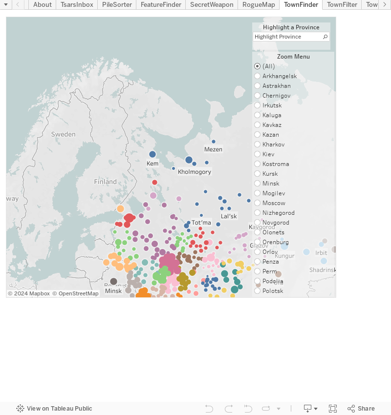
Here is a map of the distribution of town plans. The different colors denote different provinces. The bigger the dot, the more features represented on the plan. Use the highlight tool to see the location of any province's planned towns. Or, select a province from the "zoom menu" to get up close. To reset the map click "all" in the zoom menu.
How to Navigate a Gallery
When you click on a province in the table of contents, a page will open offering you 1) a locator map, 2) a set of thumbnail views, and 3) the corresponding atlas sheet.
Use the map
- Use the +/- buttons or your mouse to pan/zoom.
- Click a placemark to view the corresponding plan.
- Compare the geography of the placemarks to the historical map at the bottom of the page.
Use the thumbnail views
- Click any plan name or thumbnail to open the plan page (See How to Navigate a Town Plan, below).
- Use the browser's "back" button to return to the Galleries page, or click on the Collections link to see the set of towns in the province you are exploring.
Use the atlas sheet
- Use the toggle button in the upper right to open a full screen view of atlas sheet. You might have to wait a minute for the image to come into focus.
- If you don't know what to make of the atlas sheets, consult this map of Moscow Province. Be sure to click on the interactive areas to read the descriptions.
How to Navigate a Plan
Before we go too far, here are the 7 essential elements of a town plan:
When you select a plan from a province gallery (or locate a plan using the search box), you will open a page with 1) metadata, 2) the plan image, 3) a modern map showing the location of the town, and 4) a high-resolution viewer.
If the plan has annotations (i.e., highlighted areas with translations or explanations), they will be available in the high-resolution viewer. Use the arrow button in the upper right corner of the navigation bar to open the fullscreen view of the Pskov town plan below: it will give you a sense of how the annotations work.
Note: The annotation color scheme is consistent throughout the project: orange for current features; light orange for features not listed in the legend; blue for water features; dark blue for planned features; green for greenspaces. The texts associated with most annotations are direct translations from the legend. The features highlighted in the Guided Tours include additional commentary.